Understanding the Mercator map projection is essential for anyone interested in global geography and navigation It is a classic mapping method that has shaped our perception of the world for centuries Initially developed for maritime travel the Mercator projection offers unique advantages for sailors allowing them to plot straight-line courses easily However it is also known for significant distortions particularly in the sizing of landmasses further from the equator This article delves into the history utility and common misconceptions surrounding the Mercator map Explore why Greenland appears so large and how this projection influences our understanding of countries and continents We will also examine modern alternatives and how contemporary digital mapping solutions adapt or move beyond the traditional Mercator view This comprehensive guide aims to provide a clear and engaging overview for Gen Z and Millennials making complex cartographic concepts accessible and relevant in todays highly visual and mobile-centric world Discover the enduring legacy and evolving role of the Mercator map in mapping our dynamic planet today.
- What is the primary purpose of the Mercator map? - The Mercator map projection, created in 1569 by Gerardus Mercator, was primarily designed for marine navigation. It accurately represents angles and shapes near the equator, making it ideal for plotting courses. However, this comes at the cost of significant area distortion, especially for landmasses further from the equator, like Greenland or Antarctica.
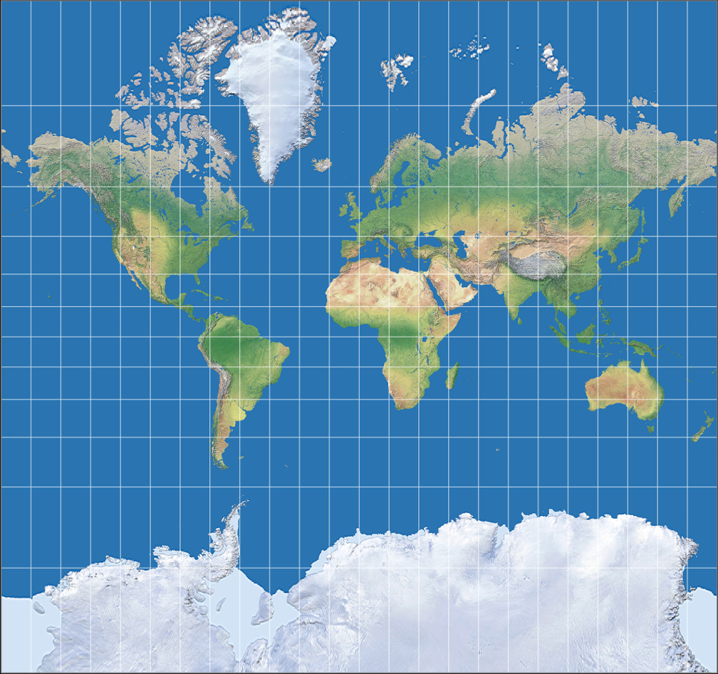
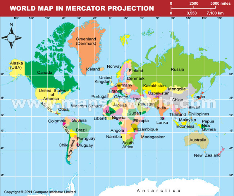
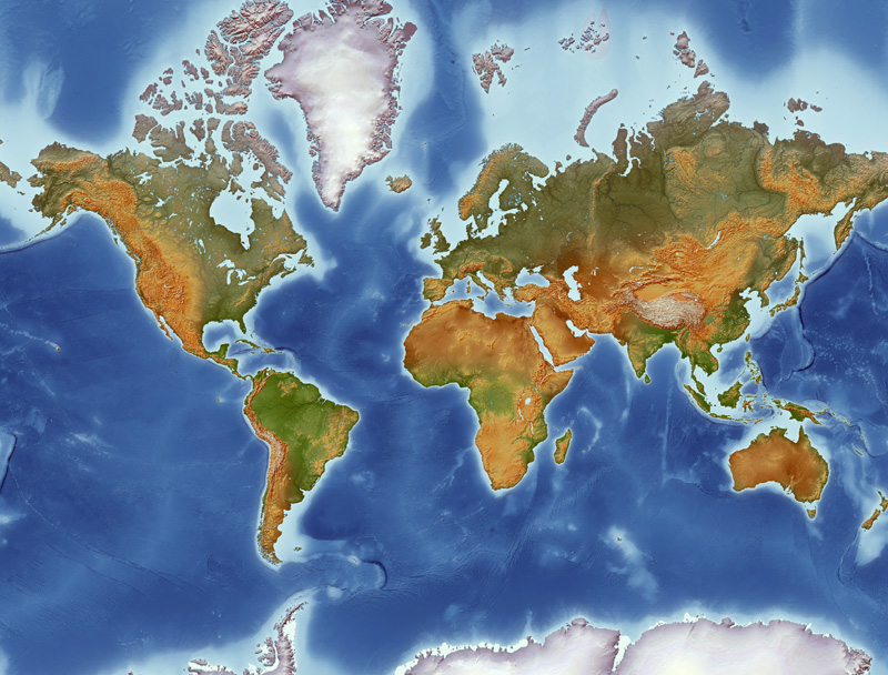
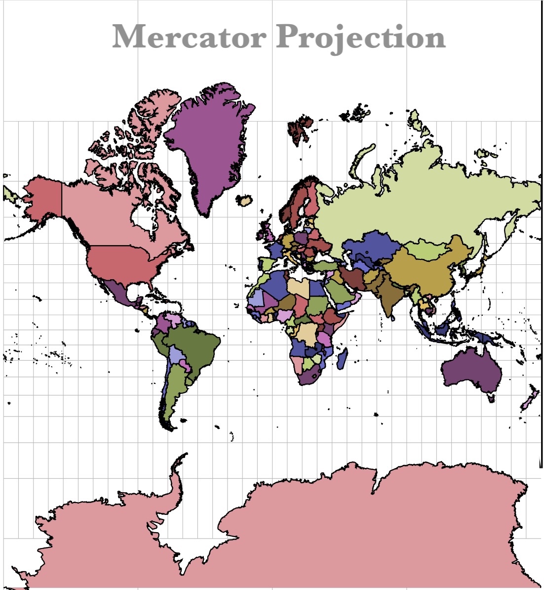
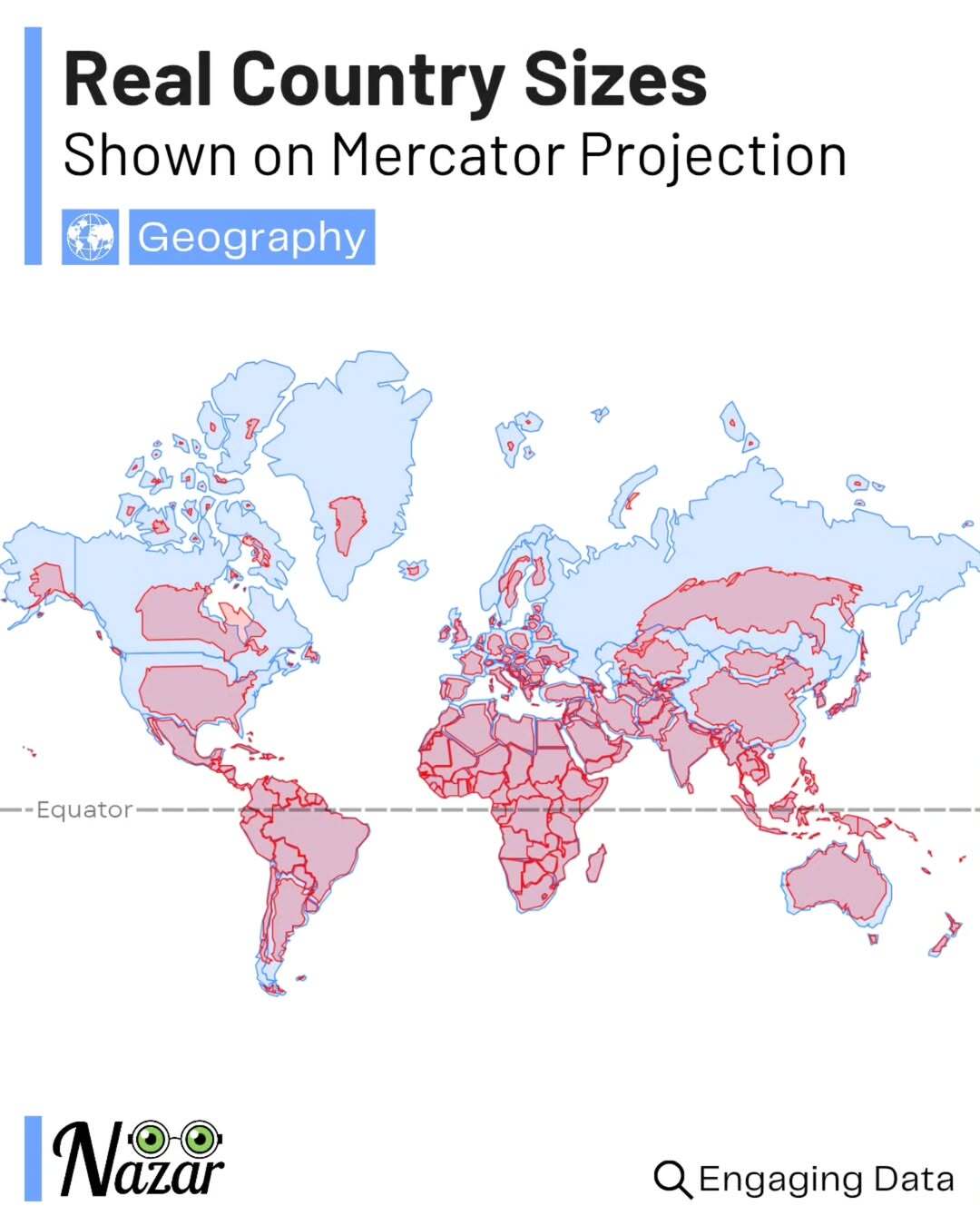
- Why does Greenland appear so large on Mercator maps? - Greenland appears disproportionately large on Mercator maps because the projection significantly exaggerates landmasses further from the equator. To maintain accurate angles, areas at higher latitudes are stretched horizontally and vertically, creating a visual misrepresentation of its true size compared to equatorial regions like Africa.
- Is the Mercator map an accurate representation of the world's landmasses? - No, while accurate for angles and shapes near the equator, the Mercator map is not an accurate representation of global landmass areas. It severely distorts the sizes of continents and countries closer to the poles, giving a misleading impression of their true scale and relative sizes on Earth's spherical surface.
- What are the main disadvantages of the Mercator projection? - The main disadvantages of the Mercator projection include its severe distortion of landmass areas at higher latitudes, making regions like Canada, Russia, and Greenland appear much larger than they are. It also cannot accurately represent the poles, as they are stretched infinitely, leading to an incomplete global view.
- Are modern digital maps still using the Mercator projection? - Many popular digital mapping services, including Google Maps, use a Mercator-like projection, especially for local and street-level views. This is because it maintains angles, crucial for accurate navigation directions. However, for broader global views, some services offer alternatives or use modified projections to reduce distortion.
- What are some alternatives to the Mercator projection for world maps? - For a more accurate global representation, alternatives include the Winkel Tripel projection, often used by National Geographic, which balances area, shape, and distance distortions. The Gall-Peters projection, another option, accurately preserves the relative sizes of landmasses, though at the expense of shape accuracy.
- How does the Mercator projection affect our global perspective? - The Mercator projection has profoundly influenced our global perspective, often causing us to unconsciously overemphasize the size and importance of northern landmasses while minimizing equatorial regions. Understanding this distortion helps foster a more accurate and equitable understanding of global geography and geopolitical scales.
- What is the primary use of the Mercator map projection? The Mercator projection is primarily used for marine navigation because it preserves angles, making lines of constant bearing (rhumb lines) straight. This allows sailors to plot a consistent course with ease, despite the area distortions.
- Why does Greenland appear so large on a Mercator map? Greenland appears disproportionately large on Mercator maps because the projection significantly exaggerates landmasses further from the equator. To maintain accurate angles, areas at higher latitudes are stretched horizontally and vertically.
- Is the Mercator map an accurate representation of the world? While accurate for angles and shapes near the equator, the Mercator map is not an accurate representation of global area. It severely distorts sizes of landmasses towards the poles, leading to a misleading perception of their true scale.
- What are the main drawbacks of using Mercator maps today? The main drawbacks include the severe distortion of landmass sizes, especially at high latitudes, which can lead to misperceptions of geopolitical significance and actual geographical scale. It is not suitable for showing true global area relationships.
- Are there better map projections than Mercator for general world maps? Yes, projections like the Winkel Tripel or Robinson are considered better for general world maps as they offer a compromise between area, shape, and distance distortion. The Gall-Peters projection, for example, accurately represents landmass areas.
- How does the Mercator projection affect our understanding of global geography? The Mercator projection has historically skewed our perception of global geography, making northern continents appear larger and more central, while diminishing the visual impact of equatorial regions. This influences our understanding of true continental sizes and relationships.
- Where can I find an accurate world map that is not a Mercator projection? You can find more area-accurate world maps using projections like Gall-Peters or AuthaGraph online and in modern atlases. Many digital mapping platforms also offer options to switch between different projections for comparison and better global understanding.
Ever wondered why Greenland looks so huge on world maps, or how sailors in centuries past navigated across vast oceans? Chances are, you're looking at a Mercator projection. This iconic map type has shaped our view of the world for over 450 years, and while it's incredibly useful for some tasks, it comes with a few surprising quirks. Let's dive into the world of Mercator maps and uncover what you need to know today.
Understanding the Mercator projection is more than just a history lesson; it's about grasping how our digital **Maps** and our global perspective are still influenced by this ingenious yet flawed creation. Whether you're planning a trip or just curious about geography, knowing the ins and outs of Mercator can really open your eyes.
Frequently Asked Questions
Where can you best understand Mercator map distortions?
The most striking distortions are seen in **Greenland** and **Africa**, where Greenland often appears comparable in size to the much larger African continent on a Mercator projection. Another good place is near the **Antarctic** region, which is often stretched indefinitely.
How do Local MAPs leverage Mercator projections for navigation?
Most digital **Maps** applications, including your phone's navigation tools, utilize a Mercator-like projection. This choice helps maintain accurate angles, which is crucial for precise routing. While this creates visual distortions of size for larger areas, local navigation typically adjusts scale dynamically for clear, immediate directions within your **Local MAP** interface.
What are the best times to learn about Mercator map accuracy?
Exploring Mercator map accuracy is best done with interactive online tools. Try comparing projections on websites like **The True Size Of...** or **WorldMap Projections**. These resources offer immediate visual comparisons, highlighting distortions effectively. Anytime is a good time, but interactive learning makes it clearer.
Quick Map Projection Guide
- Mercator Projection - Marine Navigation, Equator Accuracy
- Polar Distortion - Arctic/Antarctic Regions, Apparent Enlargement
- Area Accuracy - Gall-Peters Projection, Equal Area Representation
- Shape Accuracy - Conformal Projections, Angle Preservation
- Winkel Tripel - Compromise Projection, National Geographic Standard
All maps focus on Map Mercator
Mercator Projection, designed in 1569, is vital for marine navigation due to its accurate angular representation. It distorts areas, especially near the poles (e.g., Greenland appears larger than Africa). Modern digital maps often use a Mercator-like projection for local views but offer alternatives for global accuracy. Understanding its limitations is key to a true global perspective.


World Map Mercator Wayne Baisey Mercator 84 . Mercator Projection Map World Mercator Political Text Map Enlarged . Ocean Temperature Bulletin January 2026 Mercator Ocean Map AnomMean 202601 Glo Scaled . The World Map That Reboots Your Brain Mercator Map Square With Lines . Mercator Cylindrical Projection The Cylindrical Projection In The Mercator World Map Caitlin Dempsey .webp


Praca Wektorowa Bez Tantiem Political Map Of The World In Mercator 1000 F 1088704777 . World Map Mercator Projection World Map Printable World Map Political World Map Mercator Projection 509477 664 . Inventio Fortunata Unrelated To Harry Potter Travel Between The Pages 1207px Mercator Projection Sw.0.webp. World Map Mercator Projection Printable Physical Map Of World In Mercator Projection . 13 Projections For 2023 Intro 00 Mercator



Mercator Projection Map . Political World Map Mercator Projection Political World Map Mercator Simple Cylindrical Projection Earth Map Globe Mercator . Mercator Vs The True Size Of Each Country New Comparison Tool . Mercator Projection Map World1c . Types Of Map Projections Mercator Mercator



5 Thousand Map Projection Mercator Royalty Free Images Stock Photos Stock Vector World Map Spherical Mercator Projection Solid Style High Detail World Map For 2493873585 . Accurate Size World Map Mercator . Mercator Projection Flag Map Of The World Full By CanhDuy2006 On Dgcqhqs 1e7fbab0 C395 42eb 8216 . Mercator Peters Projection Difference Mercator Size . Mercator Projection Map GUID 3D9F5FAD 4D4E 405D BA71 Web


Large Printable Mercator Map With Us Printable US Map Vector Map World Political Mercator America One Stop Map . Why Does Greenland Look So Big On Some Maps Mercator Projection Globe Earth Land Distortion Projection Mercator Latitudes . World Map Mercator Projection World Map Printable World Map World Map Globe In Mercator Projection Plain Style Outline Vector 2NCFAK1 . Map Of The World On Mercator S Projection David Rumsey Historical Map 11569003 . What Is CRS Coordinate Reference System Martech Zone Acronyms Mercator Projection 3


Mercator Map Mercator Map Of The World San Antonio Topographic Map Mercator World Map . Historic Map The Arctic First Map Of Mercator Hondius 1606 English This Is The Second Edition Of Gerard Mercators Map Of The North Pole Or Arctic One Of The Great Most Interesting And Important Maps Mercators Arctic Projection Has Its Roots In His Magnificent 1569 Wall Map Of The World In Which Mercator First Introduces His Projection As Regards The Arctic The Difficulty With The Mercator Projection Is That To Accurately Depict The Polar Regions His Map Would Have To Be Infinitely Tall Mercator Compensated For This By Included A Polar Projection Very Similar To The Map Shown Here In The Lower Left Hand Corner MMNDB7 . The First Mercator World Map Of 1569 Story Of Ages The First Mercator World Map Of 1569 Featured 1770587954 . Gerardus Mercator Map Of Antarctica Ancient360 Mercators 1569 Map Of Terra Australis 1024x683 . What Is The Mercator Projection Atlas Best Free Mapping Tools In 2026


World Map Mercator Projection World Map Printable World Map Gpw2 Merc Ac01 . What Is Distortion In Geography New For 2026 Mercator Map Distortion . Blank Political Map Of World Political Blank World Map Mercator Projection Free Vector . Colorprint World Map Mercator Projection American Map Company 9455 50 Colorprint World Map Mercator 1 . Ch 1 Maps Are Way More Useful Than You Think Screenshot 2024 07 12 At 8.41.45 AM 1024x1024