Uncovering Florida's vast and diverse swamp ecosystems requires a good map. This guide helps U.S. travelers and nature enthusiasts find detailed maps of Florida's most iconic wetlands, including the legendary Everglades National Park and the expansive Big Cypress National Preserve. Learn where to locate critical entry points, popular visitor centers, and accessible trails for exploring these unique natural habitats. We provide information on both digital and physical mapping resources, essential for planning your trip to see Florida's alligators, diverse bird species, and lush cypress forests. Whether you are looking for specific driving directions to a boardwalk, a guide to canoeing routes, or simply want to understand the geographical spread of these vital ecosystems across the Sunshine State, a reliable map is your best tool. Prepare for your Florida swamp adventure by equipping yourself with the right navigational aids, ensuring a safe and rewarding experience in these breathtaking natural wonders.
- Which are the top swamp areas to visit in Florida? - The top swamp areas to visit in Florida include Everglades National Park, known for its extensive sawgrass marshes, and Big Cypress National Preserve, famous for its dense cypress forests. Both offer distinct experiences for observing unique wildlife and landscapes. Maps for these locations are readily available from park services.
- Are there walking trails or boardwalks in Florida swamps? - Yes, many Florida swamps feature well-maintained walking trails and elevated boardwalks. These provide safe and accessible ways to explore the wetlands without directly entering the mucky terrain. Popular spots like Shark Valley in the Everglades and areas within Big Cypress offer excellent boardwalk experiences for visitors of all ages.
- What is the best time of year to explore Florida's swamps? - The best time of year to explore Florida's swamps is typically during the dry season, from November to April. Cooler temperatures and lower humidity make for more comfortable conditions. Wildlife is also more concentrated around receding water holes, increasing your chances of sightings. Fewer mosquitoes are usually present during these months.
- Do I need a special permit to enter Florida's swamp areas? - Generally, you do not need a special permit for general entry into Florida's major swamp parks and preserves, though entrance fees may apply. However, certain activities like backcountry camping, off-road vehicle use, or specific research might require permits. Always check with the specific park or preserve beforehand for current regulations and fees.
- Where can I find maps specifically for canoeing or kayaking in Florida swamps? - Maps specifically for canoeing or kayaking in Florida swamps can often be found at park visitor centers, ranger stations, or on their official websites. Specialized outdoor recreation stores also carry detailed topographical maps. These maps typically highlight put-in points, designated water trails, and important navigational markers for safe paddling.
- Are there any guided tours available for Florida swamp exploration? - Yes, numerous guided tours are available for exploring Florida's swamps. Options include airboat rides, guided kayak or canoe trips, and ranger-led walking tours. These tours provide educational insights into the ecosystem and often improve wildlife viewing opportunities. Check local tourism boards or park websites for tour operators and booking information.
- What should I bring when visiting Florida's swamps? - When visiting Florida's swamps, essential items include insect repellent, sunscreen, a hat, plenty of water, and sturdy, closed-toe shoes. Binoculars enhance wildlife viewing, and a camera captures the scenery. It is also wise to carry a physical map and a fully charged phone, along with a waterproof bag for personal items.
What is the largest swamp region in Florida?
The Everglades National Park is recognized as the largest swamp region in Florida, and one of the most extensive wetlands globally. It encompasses a vast area of slow-moving water, sawgrass marshes, and cypress forests in the southern part of the state. Maps of the Everglades highlight its sheer scale, stretching from Lake Okeechobee towards the Florida Bay.
Can you drive through Florida's swamps?
While direct driving through deep swamp areas is generally not possible or advisable, several parks and preserves offer scenic drives that border or traverse wetland regions. Big Cypress National Preserve, for instance, has Loop Road, which provides access and views into the cypress swamp. Everglades National Park also features roads like the one leading to Shark Valley, allowing vehicle access for observation.
Are Florida's swamps safe to visit?
Yes, Florida's swamps are generally safe to visit when precautions are taken. Most visitor areas have designated trails, boardwalks, and safe viewing platforms. The key is to stay on marked paths, avoid disturbing wildlife, and heed all park warnings. Being aware of your surroundings and having a good map helps ensure a safe and enjoyable experience.
How do I obtain a map of the Everglades?
You can obtain a map of the Everglades National Park at any of its visitor centers, such as the Ernest Coe Visitor Center, Shark Valley Visitor Center, or Gulf Coast Visitor Center. Digital maps are also available on the official National Park Service website. Many outdoor recreation stores and online retailers also offer detailed topographic maps of the area.
What types of wildlife can I see in Florida's swamps?
Florida's swamps are teeming with diverse wildlife. Visitors frequently spot alligators, various species of wading birds like herons, egrets, and spoonbills, and turtles. Less common but present are the Florida panther, black bears, and various snake species. A good map can help identify prime wildlife viewing locations within different swamp regions.
Mapping Florida's Swamps Your Ultimate GuideFlorida is known for its sunshine and beaches, but beneath the surface lies a network of unique wetlands, home to incredible wildlife and lush landscapes. Exploring these swamps offers a different kind of adventure, connecting you with the state's natural heart. To make the most of your journey, understanding where these swamps are located and how to navigate them is crucial. This guide provides an essential overview for U.S. travelers looking to discover Florida's captivating swamp environments.
Why Explore Florida's Swamps
Florida's swamps are not just muddy lands; they are vibrant ecosystems, rich in biodiversity. These areas play a vital role in the state's hydrology, filtering water and providing habitat for countless species. From the iconic alligator to rare birds and orchids, the wildlife viewing opportunities are unparalleled.
Visiting these wetlands provides a chance to witness the raw beauty of nature. Many parks and preserves offer boardwalks, canoe trails, and ranger-led programs, making exploration accessible and educational. For those seeking adventure, a map of Florida's swamps opens doors to kayaking, hiking, and photography in truly wild settings.
Beyond recreation, understanding these swamps helps appreciate their ecological importance. They are crucial for flood control and serve as natural carbon sinks. Your visit supports conservation efforts, ensuring these precious areas remain protected for future generations to enjoy.
Key Swamp Regions in Florida
Florida boasts several prominent swamp regions, each with its own character and opportunities for exploration. Knowing these locations is the first step in planning your visit.
The Everglades National Park stands as the most famous wetland in Florida, and indeed, one of the most significant in the world. It covers 1.5 million acres in southern Florida, extending from Lake Okeechobee down to Florida Bay. This vast subtropical wilderness is often called the River of Grass, characterized by slow-moving water, sawgrass marshes, and cypress domes. Maps of the Everglades detail visitor centers like Ernest Coe, Shark Valley, and Gulf Coast, along with airboat tours, walking trails, and canoe routes.
Adjacent to the Everglades is Big Cypress National Preserve, a slightly different type of wetland. This preserve protects 729,000 acres of swamp, home to the largest contiguous block of old-growth cypress forest. It's an important habitat for the Florida panther and various wading birds. Maps for Big Cypress often highlight scenic drives like Loop Road, off-road vehicle trails, and designated hunting areas, along with visitor information for the Oasis Visitor Center.
While largely in Georgia, a portion of the vast Okefenokee Swamp extends into northern Florida. This blackwater swamp offers unique ecosystems and is less visited than the southern wetlands. Maps here typically show boat ramps for kayaking and canoeing, along with specific fishing locations. Though further north, it provides a different, equally compelling swamp experience for those willing to travel.
Finding Your Way Using Swamp Maps
Navigating Florida's swamps effectively ensures both safety and enjoyment. Modern maps offer a range of functionalities to aid your exploration.
Visitors can find various types of maps, from simple park brochures to detailed topographical charts. Park-specific maps, often available at visitor centers or online, pinpoint hiking trails, boardwalks, canoe launches, and restrooms. Digital maps through apps like Google Maps or specialized outdoor navigation tools can provide real-time location tracking and satellite imagery, invaluable for remote areas. Always check for cell service availability if relying solely on digital tools.
When choosing between digital and physical maps, consider your activity. A laminated physical map is durable and does not rely on battery life or signal, making it ideal for deep wilderness excursions. Digital maps, however, offer zoom capabilities, interactive layers, and sometimes real-time updates on trail conditions. Carrying both is often the best strategy for comprehensive coverage and backup in challenging environments.
Regardless of your chosen map type, always plan your route, inform someone of your itinerary, and be aware of weather changes. Swamps can be disorienting, and water levels can change quickly. Understanding the map's legends, scale, and symbols is fundamental for a safe and successful trip into Florida's remarkable wetlands. Always prioritize safety over attempting an unknown shortcut.
Planning Your Florida Swamp Adventure
A well-planned trip enhances your swamp experience. Thinking ahead about timing, gear, and tour options makes all the difference.
The best time to visit Florida's swamps generally falls between November and April. During these cooler, drier months, wildlife is more active and visible, and mosquito populations are lower. Summer brings intense heat, humidity, and often heavy rainfall, which can make conditions challenging and increase insect activity. Planning your visit in the peak season offers the most comfortable and rewarding experience.
Essential gear for a swamp adventure includes insect repellent, sun protection (hat, sunscreen), plenty of water, and sturdy closed-toe shoes. Binoculars are fantastic for wildlife viewing, and a camera captures the unique scenery. If you plan to kayak or canoe, consider bringing a waterproof bag for electronics. Always dress in layers, as temperatures can vary throughout the day.
Many areas offer guided tours, which can be an excellent way to learn about the ecosystem from experienced naturalists. Airboat tours, guided kayak trips, and ranger-led walks provide insights you might miss on your own. Self-exploration is also rewarding if you have good navigational skills and a reliable map. Assess your comfort level and experience when deciding between guided tours or venturing out independently. Both offer distinct ways to connect with Florida's swamps.
Florida swamp locations map, Everglades visitor map, Big Cypress Preserve guide, Florida wetland exploration, best swamp trails Florida, navigating Florida swamps safely


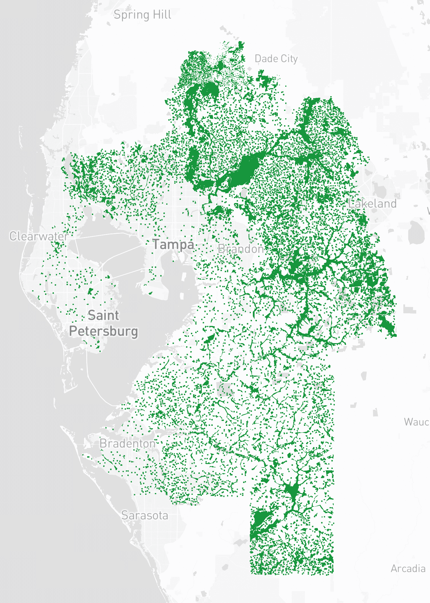

Map Of Florida Swamps F9151 . Florida Swamps Map Image Florida Population Map Png Wikipedia The Thumbnail . Florida Swamps LZKlql TDxL AgJT 0qDI . Florida Wetlands Map Printable Maps Florida Wetland Protection . Map Of Wetlands In Florida Maps Of Florida Swampland In Florida Worlds Revealed Regarding Map Of Wetlands In Florida


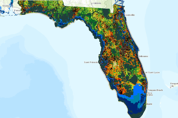

The Search For History And Drinking Water In Florida S Green Swamp 90. Florida Everglades Swamp Map Maps Big Cypress National Preserve Map Of Southern Florida Showing The Location Of Big Cypress Swamp And Important Areas . Map Of Florida Swamps . Florida Bodies Of Water Map Preview . No 21 Florida Counting On Swamp To Help Slow Down Ole Miss Star QB


Where Are The Swamps In Florida At Lora Elliott Blog There And Back With Gis March 2015 Florida Wetlands Map . Swamps In Usa Map At Anthony Galloway Blog 2048x1152 . Florida Maps WhiteClouds Florida Maps Watershed Water Quality . Scientists Need Help Tracking Hard To Find Invasive Eels In Florida 89515554007 Swamps Eels Fl Locations . National Parks In Florida Beaches Mangrove Swamps Maps Of Florida National Parks In Florida Beaches Mangrove Swamps 1024x712



Green Swamp Florida Where Five Rivers Begin YouTube . Swamps In Usa Map At Anthony Galloway Blog . Map Of Florida Swamps . In A Land Of Water We Re Running On Empty B797e4 . Swamps In Usa Map At Anthony Galloway Blog Fenvs 07 00117 G001

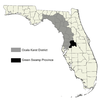

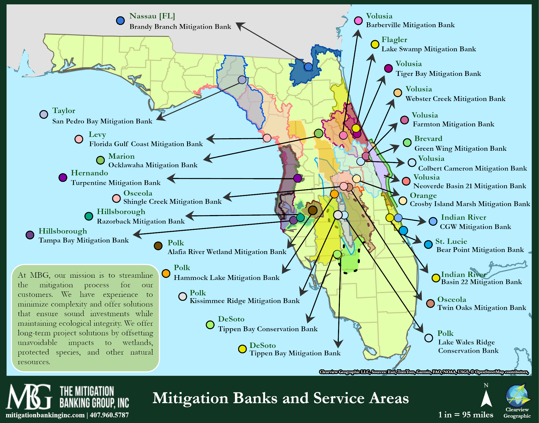

This Air Breathing Swamp Eel Is Quietly Taking Over The Florida Asian Swamp Eels Freshwater Pythons 4 . Green Swamp Florida Wikipedia Green Swamp Province . Welcome To The Green Swamp Watershed Excursion Org Green Swamp Map1 . Florida Drainage Basins Watershed Map Mitigation Credit Guide MBG Overview . Map Of Florida Swamps Land The Florida Group Florida Wetlands Map


New Proposed Rule Puts Over 80 Of Florida S Wetlands At Risk WMNF 88 Florida Wetlands By Bilanol Via IStock For WMNF News Scaled . Help Looking For Ways To Represent Forested Swamps R Mapmaking Florida Map . Swamp Of West Lake Toho Kissimmee Florida Lake Toho Florida Map . Large Florida Maps For Free Download And Print High Resolution And Florida Map 0 . Maps 2505782 Orig


Okefenokee Swamp Map Georgia Florida World Heritage Site History Lily Pads Okefenokee Swamp Georgia . The Search For History And Drinking Water In Florida S Green Swamp 90. Green Swamp WMA Brochure Map By Florida Fish And Wildlife Florida Fish And Wildlife Commission Green Swamp Wma Brochure Map Map 907890 Preview 0 3455a52d F254 47bc 8b9d . Swamps In Usa Map At Anthony Galloway Blog . Okefenokee Swamp Map Natural History Of The Okefenokee Swamp The Locator Map Okefenokee Swamp